Posts

Showing posts with the label archaeological locations in Athens

Archaeological Museum of Piraeus

Image
The Piraeus Archaeological Museum is indeed located in Piraeus, the port city of Athens. You can reach the port from Athens via metro line number 1, which is the old Athens-Piraeus railway line. Unlike other metro lines, this line runs mostly above ground, making for a somewhat bumpier ride than the other lines .  Museum Exhibition Hall, March 2022. Photo: OI Ancient objects found in Piraeus were initially displayed in a school building located right next to a Hellenistic-era theater. Map of ancient Piraeus. The museum and the ancient theater are marked with number 1, right next to the Zea harbor basin. Photo: OI In 1935, the exhibition space was officially designated as an archaeological museum and in 1966 planning was begun for a new, larger museum building, which was eventually opened in 1981 next to the old structure. The new museum has a total area of 1,400 m², while the old school building was repurposed for collection storage. The museum buildings now surround the ancient th...

Roman Agora and The Tower of the Winds

Image
During the Roman era, a new commercial center emerged in Athens, known as the Roman Agora. It was built between 19 and 11 BCE, as the older Greek and Hellenistic era Agora had become filled with various activities. The Roman Agora was designated for commercial activities. The western entrance of the Roman Agora, the Athena Archegetis Gate, photographed in March 2022. The picture was taken from inside the Agora. Photo: OI An image on an information board showing the buildings in the area. The old Agora is in the foreground, and the Roman Agora is depicted in color. In the lower part of the information board is the Athena Archegetis Gate. To the right is the Church of Sotira near Pazaroporta, and in the background are the churches of Taxiarchs and Prophitis Ilias. (Chr. Hansen, 1833) The Roman Agora and other key ancient archaeological sites placed on the current map of Athens. The image is from an information board. A combined ticket provides access to these sites. The map also indicate...

Olympieion and Hadrian's Gate

Image
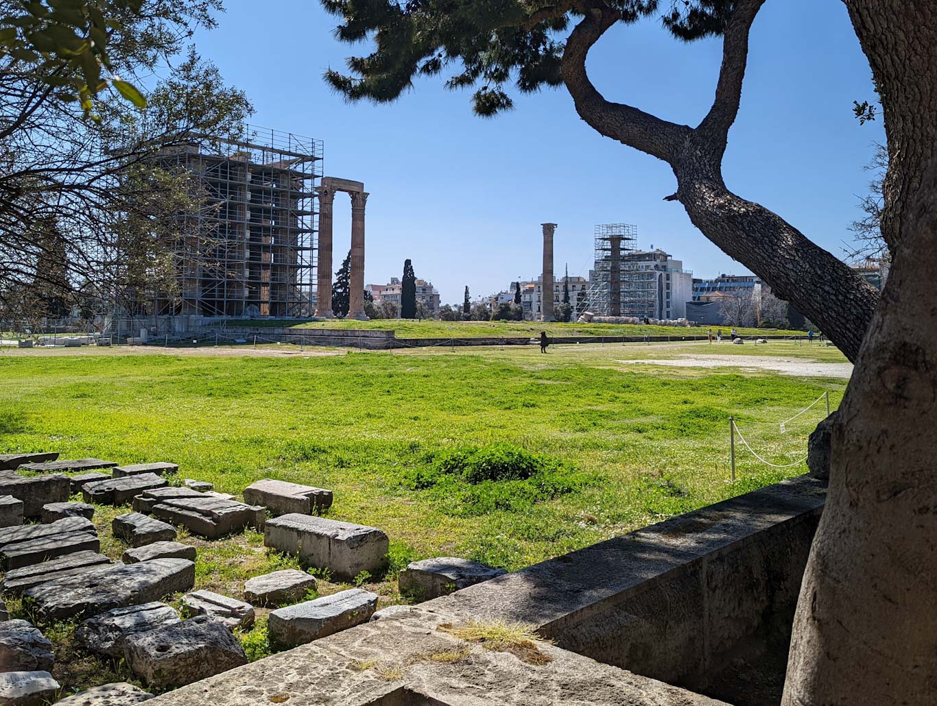
Olympieion, with its freely standing and collapsed columns, is a charming, almost Piranesi-like quality image of ancient ruins. On the edge of the archaeological site lies Hadrian's Gate.   Olympieion in March 2022. Photo by OI In March 2022, the restoration of the temple was in progress. Modern scaffolding created a new architectural layer for the site - for those who wish to view the site from a different perspective.   Several different building phases and structures have been discovered in the Olympieion area. The images include a map of the area and its explanation from an information board. At the top of the map is a Roman bath.   Olympieion was built in multiple phases. Pericles initiated the construction, but the work was interrupted after his era. The work resumed during the Hellenistic period around 100 BCE but was interrupted again.   In the 1820s, the Ilissos River still flowed freely. Edward Dodwell - Edward Dodwell: Views in Greece, London 1821, p. 59 (...

Lyceum

Image
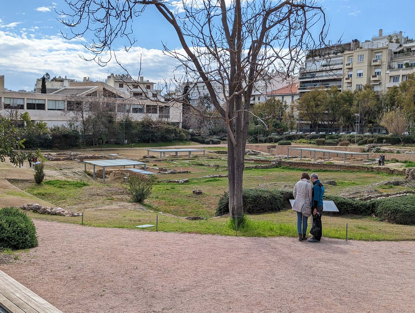
The Lyceum is a significant site related to ancient Greece, especially associated with Aristotle. As is often the case with archaeological sites, there is not much left to see on-site, and understanding the layout of the area is not the easiest task. Nevertheless, visiting the Lyceum is worthwhile, providing an opportunity to reflect on one's school days and contemplate the significance of Aristotle. The Lyceum is relatively easy to explore, and one can also combine the visit with a trip to the Byzantine History Museum, whose garden seamlessly connects with the greenery of the Lyceum. There are also other museums in the vicinity. Lyceum archeological site. Photo March 2022 by OI. The temple at the Lyceum was dedicated to Apollo Lyceus, the god of wolves. Nearby is the Lycabettus Hill, with one interpretation of its name being connected to wolves. Aristotle taught at the Lyceum in the 4th century BCE, and the Roman general Sulla destroyed the area, cutting down trees for the constru...

Lykabettus

Image
Lykabettus or Lykavittós rises to a height of 277 meters above sea level and is the highest hill in the center of Athens. Similar to the Acropolis, the hill is a prominent landmark in the cityscape of Athens.   Limestone shines through the vegetation, and at least in spring, when the plants begin to bloom, the hill becomes a charming natural destination. The hill is a splendid endpoint for views from the densely built city, but it also serves as a uniquely excellent vantage point to observe urban Athens. Particularly, there is a magnificent view of the Acropolis. Lykabettus photographed from the south, Tsimiski Street On a clear day in March, the views of Athens were excellent. In the photo, the Acropolis is in the center, with Pireus and the sea in the background. At the viewpoint, there is a small church of St. George and two restaurants. I ascended to the summit using the underground cable car. At the top, the station is directly at the viewpoint terrace and the restaurants. Cab...